Cape Wrath Trail

Cape Wrath Trail
Carrying 25 kg and feeling good

Friday, 15 April 2011

18 April - Kinlochewe to Achnashellach (Jerry's Hostel)


Kinlochlewe Bunkhouse to Achnashellach (Jerry’s Hostel)
(11 miles         6 and a quarter hours walking)

Back home in Salisbury I had planned to walk from Kinlochewe to Bearnais Bothy – however my knee had been very sore on the previous day and I was reluctant to do an 18 mile and a 16 mile walk back to back. So I went for plan B, and aimed for Jerry’s Hostel (which two walkers at Kinlochewe Bunkhouse had recommended the previous night)

Photo from phone when I left Kinlochewe


The weather today was absolutely stunning. I stopped at the post-office in Kinlochewe to buy a packet of mints and a cake. I still have some of the mints with me now (It was a large packet!). I took the road (the A896) south from Kinlochewe as everyone I had encountered had advised against the footpath that follows the east side of A’ Ghairbhe as being very hard indeed to negotiate. Tom (the CWT website manager) had also recommended following the road due to the presence of deer fences and fallen trees on the footpath.
About a mile out of Kinlochewe I passed Cromasaig, where Tom lives, and was just looking at his useful weather chart when Tom himself appeared. “Rachel?” he said.
“Yes. Tom?” I replied. He was clearly expecting me and we talked a bit. I was glad to know he had been following my progress and promised to write up my trip report as soon as I could.


Tom offered me a cup of tea but I wanted to press on as I had made a late start that day (10 a.m.!!). He was very helpful about the route and I took every part of his advice gratefully.
I followed the A 896 as it curved toward the SW and then took the track south, which crossed the river A’ Ghairbhe and followed the East coast of Loch Clair.  

This sign made me smile. Surely the possibility of bumpy roads is to be expected in the highlands?


At the shore of Loch Clair I decided – tics be dammed- I’ll put my shorts on. Very shortly afterwards I met a party of 4 men all doing a section of the Cape Wrath Trail and realised I needed to slightly more careful about where I got changed!!


The path followed the north-east side of Loch Coulin, passed a few houses, and then started to climb south and then south-west to the Teahouse Bothy. Up until the Teahouse Bothy the path was really excellent and a 4-wheel drive vehicle could have used it. I stopped here and made some tea and ate my cake in the sun. What a blissful spot. The bothy was tiny but had a table and space for a few people to sleep in (at a push). It was dry, tidy and the logbook showed it was a really well-loved place. I noted in my journal that I removed a tic here, but decided to keep the shorts on anyway.


The 3-kilometre stretch south-west from the Teahouse Bothy sticks in my memory as the most beautiful part of the entire walk. The weather was perfect and the landscape fabulous. It was really big-scale, mountains and rocks were all around me, the ground was dry, the path easy to follow, and my spirits soared. My knee was absolutely fine and I contemplated pushing on to Bearnais Bothy after all.


I met another group of walkers doing a section of the CWT – this time 5 men from Switzerland (I think).

The photo below was taken at the cairn Drochaid coire Lair looking WNW up the valley that follows the River Lair. I would love to have followed that valley and was never more tempted to deviate from my path than on this day. The mountains (Sgorr Ruadh and Fuar Tholl) towered over me like beautiful, benevolent protectors. What a place. The photos don’t do it justice.
What goes up must come down, and there was a very steep descent down to Achnashellach Station. My knee started to play up again and I decided that I would stay at Jerry’s Hostel after all. There was the promise of a ‘cafĂ©’ of some sort at Achnashallach but it was closed. The railway station was very quiet and when I got to the few houses that made up Achnashellach it dawned on me that I had absolutely no idea where the hostel was. I had a 50/50 choice – go east along the busy A890 or go west along the busy A890. My map gave no clues and there was nobody to ask. I opted for west for about 10 minutes and, finding the houses even fewer and further between with every step, back-tracked and headed east. Fortunately I found someone to ask, and it turned out that he was Jerry’s son (of Jerry’ Hostel fame). There aren’t that many people in the highlands! Jerry’s son gave me a lift to the hostel, which was about 2 miles east of Achnashellach at a place called Craig. The road was very busy and would have been rather dangerous to walk along, so I was very grateful indeed for the lift.

Jerry was very welcoming and showed me round the hostel. It is a fabulous and very interesting place to stay. Jerry has run it since 1969 and is quite a character! He lit a wonderful fire that night and demonstrated the lovely smell of incense you get when you use Caledonian pine and cedar as fuel.
His hostel has a little store – called “Highland Harrods” and I augmented my dried pasta meal with tinned peas and carrots, and some bockwurst. YUMMM.


The only other person staying at Jerry’s Hostel was – would you believe it – another Science teacher. He was teaching in Kent (Petersham?), 60 years old, and nearly as tired as I was.

The dormitory bedroom was large and comfortable. Jerry provides sheets and duvets for an extra £1 per night. The shower was hot, the kitchen had everything you could want, and there was a wonderful record player and supply of records. We listened to Elgar, read our books and talked about OFSTED. It was all quite bizarre.

I went to bed at about 9.30 and slept like a baby.


Thursday, 14 April 2011

19 April - Achnashellach (Jerry’s Hostel) to Camus Luinie


Achnashellach (Jerry’s Hostel) to Camus Luinie
(12  miles        7 hours walking)

The first thing I had to do was get back on track – having shortened yesterday’s distance due to concern about my knee.

The other teacher and I both apologised to each other for possibly snoring, but I think we were both so tired that we heard nothing.


Jerry’s hostel is right next door to the railway line, and consists of three railway cottages knocked together. Fortunately the trains don’t run during the night, so a good night’s sleep is guaranteed.
After a lovely breakfast of porridge (I still wasn’t fed up with it) I set off to hitch back towards the Strathcarron/Atterdale area. This seemed like my best option to a) shorten my route slightly and b) rejoin the CWT a.s.a.p.


My faith in being picked up quickly was soon shaken by the speed of vehicles on the road and the number of lorries and tourist buses that passed me at great speed, completely ignoring me. However, after about 20 minutes of walking west I was picked up by a kind man and taken SW from Craig to the junction of the A896 and the A890. One mile of walking SW took me to Strathcarron where there was a pub, shop, post office and railway station. There were a surprisingly large number of people loitering, I found out, to see a rather special steam train which was due at the railway station any minute.
I bought a coffee in the bar and hung around for a while, and was lucky enough to see the train. I’m not really a steam train boffin (grandpa would have loved it) but I thought I ought to take a photo anyway. The people inside the train were wearing jackets and posh frocks and being served meals at ornate tables with candelabras on. It was a million miles away from my experience of Scotland.


If i was going to cheat this would be the way to do it!
The weather on this day was overcast and potentially midgy, but the sun kept trying to get through the murk and by 11.00 I was back in shorts and a T-shirt. There were many tics today and unfortunately they seem to like my blood so this was the last day that I wore shorts.

I took a footpath SW from Strathcarron which was fairly easy to follow, although I had to keep my eyes open and was once again very glad I had a large—scale map. I climbed steadily uphill until I intercepted a long fence running almost due East-West across the hills. I have no idea what this fence was for. It certainly wouldn’t have prevented deer from moving between the two areas and must have been a boundary demarcation. I was extremely impressed by the sheer effort that must have gone into its construction and followed it East until I reached Bealach Alltain Ruairidh. The surrounding mountains were not as high as on previous days, but the countryside felt very empty and remote.
Unfortunately I was a bit inept with my camera on this day, and most of my photos came out rather bleached.


Once I got to Bealach Alltain Ruairidh I had to alter course to the SW and follow the very clear track (cars could use it) heading SW through the Attadale Forest (no trees again) to Loch an Droighinn


The descent to the loch was very steep indeed, and I was quite impressed to see a cyclist ascending these hairpin bends, pushing his bike very cheerfully and anticipating the downhill parts. Fair play to him!


I descended south to the River Ling, and then followed the River Ling due south towards Killilan. Willie’s bunkhouse at Camas Luinie was very clearly signed, and I was very relieved to finally get there at about 4 p.m.


Willie himself had left a note telling me that he was in Glasgow for the day and would be back later, but he directed me to make myself at home and told me where I would be sleeping. The bunkhouse was out of action due to a water leak (I think) but I was directed to stay in “Tigh Iseabhail” (Isabel’s House).
I went upstairs and found myself in the lap of luxury. I was the only person in my room and had an en-suite toilet and shower. There was central heating, T.V, and a fully-equipped kitchen. Bliss.

There was also a note for Willie in the kitchen from the couple who had left that morning, saying that the man had proposed to his girlfriend near the Falls of Glomach (where I was heading the next day) and had been accepted. How romantic! It felt like a good omen to me.


My food parcel was neatly waiting for me near my bed and I was very grateful for the care and attention to detail Willie showed me on my stay there. There was no phone reception but a phone in the bunkhouse for visitors to use, so I made a quick call to Andrew letting him know that I was safe.

Then I had some chores for the evening:
  1. Wash my trousers (for the first and only time on the trip). It was perfect drying weather so I washed many of my clothes and even woolly socks. It was all dry in the morning. Incidentally I have been very impressed with Rohan kit.
  2. Tic removal. I made good use of the tweezers in my Swiss Army knife and found about 6 tics on my legs. Yuck. But I was starting to get used to them
  3. Cook some pasta.
Three young Frenchmen came by while I was (embarrassingly) removing tics form my legs and asked for water and direction to the Falls of Glomach. I gave them directions to the waterfall but there was a note saying the bunkhouse water needed to be boiled before being drunk. Apparently there had been a case of TB recently and the environment agency had made this recommendation. It was ridiculous really, as everyone drinks water from the stream without boiling it, and the water in the houses was exactly the same stream water. But I guess you have to do what they say.

Willie came round at about 7.30 with eggs and bread for breakfast. I thanked him and said I had been looking forward to the eggs for days, and he came round later with two more, which he suggested I hard boil for my lunch the next day. I did exactly that. What a very kind man.
Then I watched some absolute junk on T.V.; ‘Eastenders’, ‘Supersize vs Superskinny’, and ‘Don’t Pimp our Children’ (a Channel 4 sex education programme). Absolute rubbish all of it. I slept very well.

Wednesday, 13 April 2011

20 April - Camus Luinie to Glen Affric Youth Hostel

Camus Luinie to Glen Affric Youth Hostel
(16.5 miles              7 and a half hours walking)
What a great day. What a destination.

Willie had warned me that the route to Glen Affric was hard, so I got up and left early. I was walking by 07.45 a.m.

But not before I enjoyed that plate of scrambled eggs on toast I mentioned early. Thanks Willie. What marvellous hospitality.

The weather was calm and hazy, with just a hint of a breeze to keep me cool. I hoped very much the mist would lift and remove any navigation fears.


My path followed Glen Elchaig east through an area that felt really ancient. I crossed the river at Coille-righ and continued east along the north side of the valley. The track was excellent and clearly used by vehicles to access farmland. There were many signs that humans had lived her for centuries; with a few old dolmen-type structures to be seen and really old walls and ruined shielings.

This post was almost worn through by it’s previous use and I wondered if there had been a gate there once? Or perhaps animals had been tethered there? Either way, it was a rather beautiful object.
I got very close to several herds of red deer, who seemed completely unfazed by my presence and just watched me pass with vague curiosity. It was wonderful to get so close to them, and I didn't feel in any danger at all.
At Loch na Leitrach I turned south and completed the challenging ascent to the Falls of Glomach. The ground was steep and slippery, and in places I had to haul myself (and my pack) up some quite serious scrambles, with steep drops on my left to raise my adrenalin levels. I was very glad I was ascending rather than descending this route, and would advise heavily-laden walkers to think twice before descending from the Falls of Glomach as the route is quite dangerous.
The information provided by the sign at the top was:
 a) too late for me and b) quite obvious in any case


From the Falls of Glomach I headed east and then south following Abhainn Gaorsaic. There was no path here, but I stayed on the west side of the river for a few kilometres and then crossed – using Andrew’s rubble sack method – to the east side. Both sides of the river were pathless and seemed quite boggy and difficult, but it was always clear which direction you had to go in. So I just took Churchill’s advice to ‘Keep Buggering On’ and after a bit of a slog I made it to Loch Gaorsaic.

The walk took me through a stunning secret valley, with very few signs that humans had ever been there. I heard lots of cuckoos and saw a loon (Great Northern Diver) on Loch a’ Bhealaich. There was a small path marked on my map heading south along the side of the Loch, and I tried to find it. However the route marked on the map had been masked by 4-wheel drive paths and I got rather annoyed by this occurrence over the next few days. It seems that 4-wheel drive vehicles do not drive in single file but follow any route they like along the hillside, which makes sense for them, I suppose. But it means the least well-used footpaths, which are faint at the best of times, are confusing to find and frequently masked by tyre tracks. Anyway, to cut this rant short, I failed to find the path and just headed cross-country and rather wearily south to the junction of the path running east-west from Glen Affric to Morvich.

At this point I met a Frenchman with no map, wearing black brogues (suitable for working on a building site but not trekking!!) and following his compass to get him to Morvich. He asked me where he was and I told him exactly where he was. I was slightly bemused by his lack of concern about being lost and his simple confidence in “If I keep going west I will get to Morvich”. I guess the old pilgrims and shepherds had no maps either.

When I was finally on a proper path near Allt Gleann Gniomhaidh, I rewarded myself (as I had been promising myself I would for miles, it seemed!) by stopping for a rest and brewing up some coffee. I had one of Willie’s hard-boiled eggs and was very happy to be alive. I congratulated myself on having covered some quite difficult terrain in good time and felt very fit. From that point it was only a few miles further to Alltbeithe, or Glen Affric Hostel.
The path east was boggy and hard-going, but to my complete amazement at about 3.30 p.m. I met a Scottish cyclist with a ROAD BIKE (!!!) wearing deck shoes, and also heading west for Morvich. He was naturally pushing his bike over the uneven terrain, and was taking his bike to Morvich so he could cycle home the next day. I thought he was crazy, and was less concerned about his wet feet than his chances of getting to Morvich before it got dark! Not that I told him that. Each to their own.

Shortly afterwards Alltbeithe Youth Hostel came into sight.
There was a lovely warden called Colin, who was originally from Birmingham and had left his job to get away from it all. He lives at Alltbeithe hostel 3 weeks out of 4 and I am very envious of him. His story was inspiring and motivational but is not mine to tell. He was very welcoming and allowed me to beat him at chess that evening.
Another person staying was Momo from Spain, a trainee psychologist who was travelling all over the place and looking at different religions as he went. Momo did not allow me to beat him at chess! There was also a Swiss family who had thought they could drive directly to the hostel and had walked up from their car without sleeping bags, and a lovely family from Sheffield. We made quite a jolly crowd.

There is no electricity at Alltbeithe, but is a small wind turbine which provides enough electricity to charge a phone or GPS (so long as the wind is blowing!). There was no phone reception and no phone at the hostel; although Colin said he was expecting a phone to be delivered, for emergency purposes. He said that if I walked for 1 hour up the steep hill opposite the hostel I would get a phone signal, but I decided not to bother! Sorry Andrew but there is a limit..
This picture shows Momo and the fire in the kitchen.

There is no central heating at the hostel, but the fire is connected to pipes and provides enough hot water for a brief shower and wash. Colin got up at 5.30 the next morning to light the fire so we could have hot water to wash with.
That evening I discovered another tic on my back and asked Rachel (the woman from Sheffield) if she would remove it. She tried but was too squeamish so we asked Colin if he would do it. What a diamond.

                                               Me, Momo and Colin

I couldn’t be gladder that I went to Glen Affric Youth Hostel. I met some real kindred spirits and even though we were from different parts of the world and different classes and cultures, we spoke the same language. We understood each other. You can’t put a price on the sense of belonging that gives. I felt really at home there.

Tuesday, 12 April 2011

21 April - Glen Affric Youth Hostel to Cluanie Inn

Day 14:    21 April 2011
Glen Affric Youth Hostel to Cluanie Inn
(7 miles           4 hours walking)
I didn’t sleep too well in my bunk-bed – I was itchy and restless (which was possibly a mild reaction to tic bites) and was awake at 5 a.m. After listening to the sound of silence for a while I got up at 6 a.m. and went for an early morning walk to the bridge across the river. There is a beautiful suspension bridge to cross which resonated (swayed alarmingly) as I crossed it again later in the morning.

Here you can see the bridge across the River Affric and Alltbeithe hostel in the background.

It was another warm, calm, hazy day and perfect for walking. Once again I counted my blessings.

I had tea and a chat with Colin, porridge for breakfast, and left the Youth Hostel at 09.00

Spanish ‘Momo’ said goodbye and left at 08.30, telling me I would certainly catch up with him. He was aiming for the same destination as myself but thought he would be slowed down by his sore knee and huge pack. However I never did see him again, despite his bad knee and 30+ kg of baggage! (Momo had arrived left at Alltbeithe a few days before, very overburdened with food, lap-top etc, and had needed a day of rest before returning to ground level. We had made a tenuous arrangement to walk to Cluanie together)

I noted in my journal that there was still no mobile phone reception, and it had been more than 2 days since I had uploaded a picture and message to my blog.

The path from the suspension bridge followed the River Affric SW for about a Kilometre and then headed almost due south along An Caorann Mor. I have to say that this path was, for about 4 km, pure bog. I endured 3 and a half hours of sinking into squidgy sphagnum, sliding down boggy slopes, jumping over black muck, and getting gradually wetter and wetter feet. It was absolutely exhausting to walk on, and not helped by the occasional misleading ‘path’ created by 4 wheel drive tracks.
Still it was stunning countryside, there was no getting away from it. I kept expecting to catch up with Momo but there was no sign of him.
In the valley adjacent to the eastern slope of Am Bathach the boggy path finally joined a proper track, which was a huge relief. I stopped for a break under the slopes of A Chralaig (1120m) and heard the bizarre sound of a snipe. The sound made by this bird is really strange, and doesn’t sound like any other bird I have ever heard; it was more like the sound of wind whistling through telegraph wires. The sound appeared to come from the sky, but however hard I peered upwards and around me, I could see no birds.

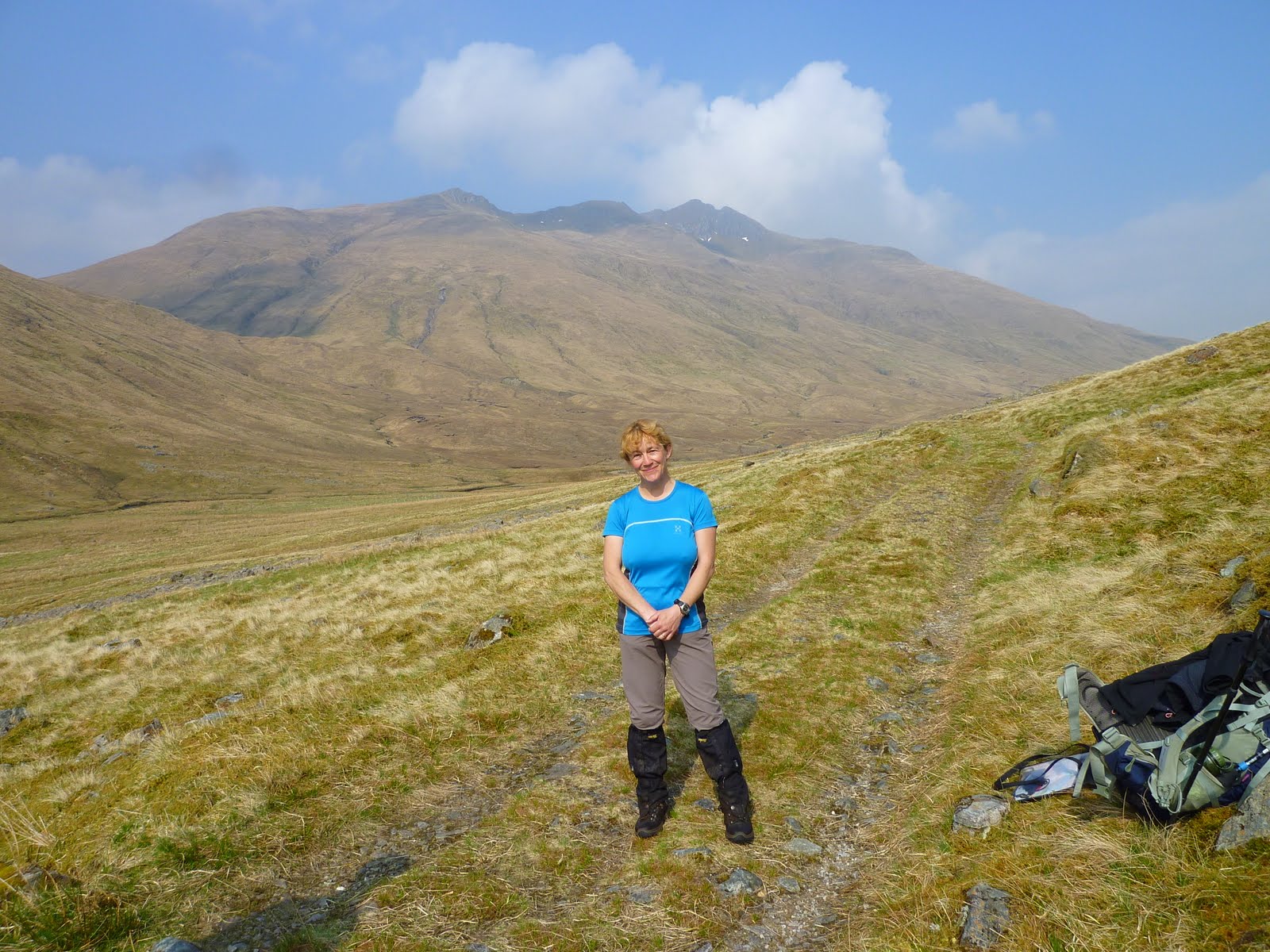
I was still listening to the sound, bemused and wondering if I was going insane, when I met two men wearing shorts and intending to ascend Ciste Dhubh (979m). I don’t know what their names were but they had two Highland Terriers called Hamish and Angus. One of them (the men, not the dogs!!) was a professional landscape photographer, and took this photograph of me. They hadn’t heard the strange birdsong so I kept quiet about it, in case I was actually going insane...!

I continued the descent to the busy A87, on the slopes of Loch Cluanie. There was still no phone reception, although I kept trying to send a text message every kilometre or so, convinced Andrew would be thinking I was dead and would send out the search parties for me!


From the A87 it was a one mile walk west along the main road to Cluanie Inn. This was a very fast road and no pleasure to walk along. Still, the weather was warm and dry, and the pub beckoned.

When I got there all my hopes were realised, although there was still no phone reception and the tempting phone box said ‘Emergency Calls Only’.
My first duty was to phone up Andrew from the phone box in the pub. My second duty was to get a pint of cider and a packet of cheese and onion crisps and to sit in the sun and enjoy them. It was pure pleasure. There were other travellers around, who pitched up in cars at regular intervals, ate in the sun, and drove off again.
I checked in quite early (at about 3 p.m.) and had a lovely hot bath and (not so lovely) tic removal session. I had a nap before supper and watched an episode of Midsomer Murders on the television in my room.

That evening I ate something proteinacious (fish and chips I believe) at the bar, and drank red wine in the company of various walkers who appeared and disappeared. I spent a rather jolly evening talking about kit/routes/philosophy to other like-minded people. My intention to have an early night did not materialise.

Near glen affric. Hazy but hot. Very wet ground desite no rain for a week. The mountains just go on forever.

Monday, 11 April 2011

22 April - Cluanie Inn to Tomdoun


Day 15:    22 April 2011
Cluanie Inn to Tomdoun
(13 miles         6 a three quarter walking)
I had a FABULOUS breakfast of Altinabuie kippers (from a local Loch), scrambled eggs, toast and marmalade and orange juice, all washed down with lots of tea. Then I paid my bill and headed off into the hills.
It was another hot, dry, sunny, hazy day, and I wore a T-shirt from the start.
(N.B. As I write from my home in Wiltshire this on 28th May, I have switched on the central heating at home for the first time in weeks!!) I saw lots of deer today.


The path was initially an excellent track heading approximately south towards Loch Loyne. It was easy to walk on and sloped steadily uphill, skirting Creag a’ Mhaim. I saw two other walkers in the distance early this day, but believe they were bagging nearby Corbetts and Munros and would eventually return to their cars on the main road. At the top of the valley, before the track crossed Allt Giubhais, I took a smaller track west. The main continued ESE to Loch Loyne and ultimately ended in a dead end at the lakeside shore, according to the map!

At this stage I went quite astray and missed another fork in the path, causing me to take a completely unnecessary detour to the summit of Creag a Mhaim (947m). I realised about half way up (having come out of my happy trance) that I was quite astray, but the bloody-minded cell in my brain made me continue to the summit, and I didn’t regret it.

Then I descended down through “the Valley that Time Forget” (or so it felt) to the north of Creag Liathtais to the epic River Loyne Valley. This was a great place; lonely, surrounded by mountains, and utterly unspoilt.

I met a real CWT ‘er here on his third day from Fort William. We swapped trip notes and thoughts about the route. He had attempted the route before, and had failed (he said) due to the speed and distance he believed he could cover.
On his first attempt he had walked from Glenfinnan to Tomdoun in one day; not to be recommended. This is him heading north (the way I had come) after our meeting at the River Loyne. He was the only other walker I met all day.


I really needed all my micro-navigational skills for this part of the day, as the path through the valley and across the river Loyne was not at all clear. Again, my 1:25,000 map proved indispensable, as I was able to identify and find an almost perfectly circular island in the River, which I used to precisely fix my position. The path through the wooded enclosure south of the River was also not clear, and the trees were mostly cut down, so I relied upon a compass bearing and mark one eyeball. There were two very large (and hard to climb with a heavy pack) stiles marking the path entry and exit routes through the enclosure, and these helped me find the correct route.

Looking back NW into the River Loyne Valley from Coire Dubh Mam na Seilg


Once these navigational hazards had been conquered, the path became clearer and it was a steady ascent and steep descent to the pretty road following Glen Garry.
Quite close to the road, while descending (of course), I fell flat on my face and was pretty certain I had really damaged my knee. However after a few minutes lying with my face in the mud and my pack pressing me down, I realised I would have to try to move. I wriggled my leg and managed to stand up. My knee was sore but not worse than normal, so I carried on gingerly and was soon walking quite confidently. It was a wake-up call reminding me of the dangers of solo walking.
The warning on this sign that I was entering (exiting in my case) “remote, sparsely populated, potentially dangerous mountain country” was heeded.


I decided that I would continue to Tomdoun Hotel, as I had some idea that the owner allowed people to camp in his grounds, and I thought it would be nice to have a meal there. I was starting to think about the end of the trip, and wanted to make the most of the last few days. And after all I was on holiday!!! The detour added an extra 1.5 miles to my trip and was quite a hard slog along the tarmacced road, but was worth it.

The owner of Tomdoun Hotel showed me where I could camp about 100m from the hotel, on land owned by the hotel. The site was dry and there were some useful trees for tarp attachment points. It was quite windy and there was rain in the air, so I used all my spare guys.


I sat outside the hotel for a while with a party of men from Edinburgh who were on a ‘fishing’/mountain biking holiday. They were very friendly.

We saw an osprey in the distance and many swallows. The view across the valley was excellent.


I asked the owner if I could have supper there and he said “we eat at 7.30”. I started to be aware that my only spare shoes were crocs, and I had no skirt etc, but it didn’t matter too much.

The food was cordon bleu and served under chandeliers. I had cod and the Scottish cheeseboard (to replenish my protein levels) and it was excellent. I sat down with another walker called Steve, an Australian called Hazel, and her girlfriend (the chef at the hotel) whose name was Celestine. The seven fishermen from Edinburgh were on an adjacent table. Afterwards we all gathered around the Grand Piano and sang songs. I was persuaded to play the piano (badly) and sing, but the landlord’s girlfriend, a Polish (?) woman, was a real expert on the piano. There were 140 different whiskies at the bar and I tried some Glenmorangie, in memory of the film “Highlander”.

I was treated with great respect all evening despite the fact I was wearing crocs, would be sleeping in a tent, and my handbag was my orange food bag (converted).

 If you want a fabulous experience with a touch of the surreal added in, come here. I felt as if I had wandered into an Agatha Christie book.

This was sent from my phone at same stage today...

Phone reception at last! All is well. I am half way between cluanie and tomdoun. Weather is perfect. No midges. Mountains are breathtaking. Awesome. Do i really have to go back to work on tuesday?

My camp for tonight. Got a long 18 mile day tomorrow and rain forecast for the morning so hoping for my good luck to continue. Staying in tomdoun tonight.